A two-day Geographical Information Systems (GIS) training class will be held at Oregon Institute of Technology in December. "Introduction to ArcGIS I" will be taught from 8 a.m. to 5 p.m. on Monday, December 14 and Tuesday, December 15, in the OIT GIS Service Center laboratory located in room 130 in Owens Hall. The cost for the course is $725.00.
This is an ‘ESRI authorized' course (Environmental Systems Research Institute). ESRI is clearly the world's leader in providing state-of-the-art GIS software. This is the same course that is offered in dozens of locations around the world.
The course will enable the GIS novice to leave with a basic level of functionality with the software. Geographic Information Systems involves the creation and use of a "smart map" for addressing geospatial issues pertaining to the disciplines of archeology, urban planning, geomatics, health sciences, management, environmental sciences, and many more. This course covers fundamental GIS concepts as well as how to query a GIS database, manipulate tabular data, edit spatial and attribute data, and present data clearly and efficiently using maps and charts.
Prospective course attendees must be comfortable with fundamental computer skills such as file management and Windows-based software. Attendees typically include those from local city, state, federal agencies as well as the general public.
OIT Professor John Ritter, an authorized instructor through Environmental Systems Research Institute, is teaching the course. Ritter is the Director of the OIT GIS Service Center and teaches numerous GIS classes at OIT. He is also the president of Aspen GIS Services, Inc., an ESRI Business Partner.
Students who successfully complete this course will earn a certificate stating that they have attended and completed an ESRI authorized course. Visit www.esri.com to learn more.
To register for the course, contact Professor John Ritter at (541) 885-1495 or john.ritter@oit.edu.
-
About

Oregon Tech is a public university recognized as Oregon's polytechnic based in Klamath Falls and the Portland metropolitan area, with a presence throughout the Pacific Northwest.
-
Academics

Oregon Tech’s in-demand graduates realize a high return on investment, with a $60,000 median starting salary.
-
Research & Partnerships

The new Center for Excellence in Engineering and Technology is home to multiple departments and includes 70,000 square feet of new classroom and lab spaces.
-
Admission & Aid

Visit Oregon Tech online! Take a walking tour with our virtual tour guide to explore the sights of our beautiful campus.
-
Campus Life
Oregon Tech is a public university recognized as Oregon's polytechnic based in Klamath Falls and the Portland metropolitan area, with a presence throughout the Pacific Northwest.

Two-Day GIS Course Offered at OIT
-
Klamath Falls
Tarrah Bickford presenting at IdeaFest in Klamath Falls
Oregon Tech…
-
All Locations
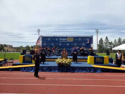
The Oregon Institute of Technology Klamath Falls Class of 2024 moved its mortarboard tassels to the left as President Nagi Naganathan, Ph.D.,…
-
All Locations